

ORLANDO, Fla. – Even though we’ve yet to hit the official start of the spring season per our calendars, it’s safe to say we’re already feeling the fever of spring kicking in across Central Florida.
We’re seeing more warmer afternoons and less chilly evenings. Rainfall is starting to tick up more and more, with less dry air to go around for everyone.
One tell-tale sign of spring’s arrival is the consistent threat of severe weather somewhere across our state. Usually it’ll stick to the northern periphery of the Florida peninsula, but as we experienced this past Monday, there are opportunities for the threat zone to shift further southward.
[CRAZY VIDEO: Cameras catch storm as EF-2 tornado rips through Longwood]
The question posed today is, when will it happen again?
Notice I didn’t say “if” it will happen again. It’s only a matter of time as we transition further and further into the spring thunderstorm season. There’s a reason why spring is synonymous with severe weather, and especially tornadoes.

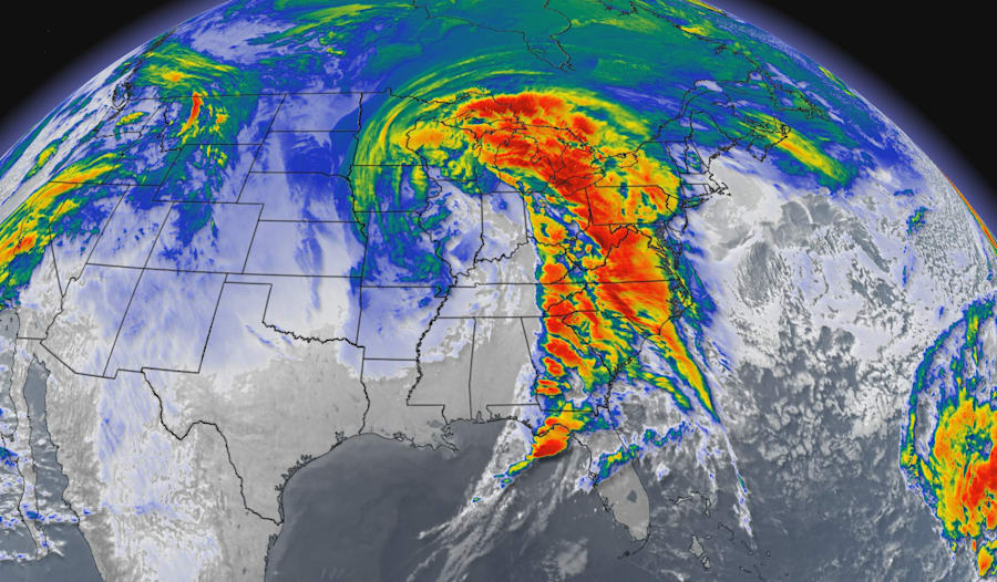
We’re already currently pinpointing yet another prolific bad weather player coming up in the next couple of days. While the threat is primarily confined to tornado alley, the Midwest, and the Gulf Coast states to our northwest, there is still a shot Central Florida realizes some thunderstorm action as the tail end of the feature sweeps down.
Surface storm energy looks OK, however it does appear some lingering dry air may place a cap over us and prevent any major thunderstorms from trying to get going.
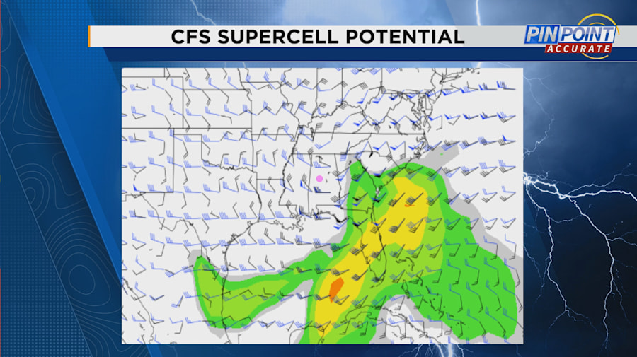
Looking long-range using a few of our dynamical computer models that go beyond the 7-10 day time frame, I’m tracking two if not three potential windows where Florida may be bracing for more robust storm activity.
The last week of March is first up, with supercell parameters and surface instability starting to rise yet again as another possible low-pressure system fires up across the heart of the country. There are indications the subtropical jet, which is currently present flowing from northern Mexico, through parts of Texas, the upper Gulf Coast and over Florida entirely, could provide some enhancement to future storms.
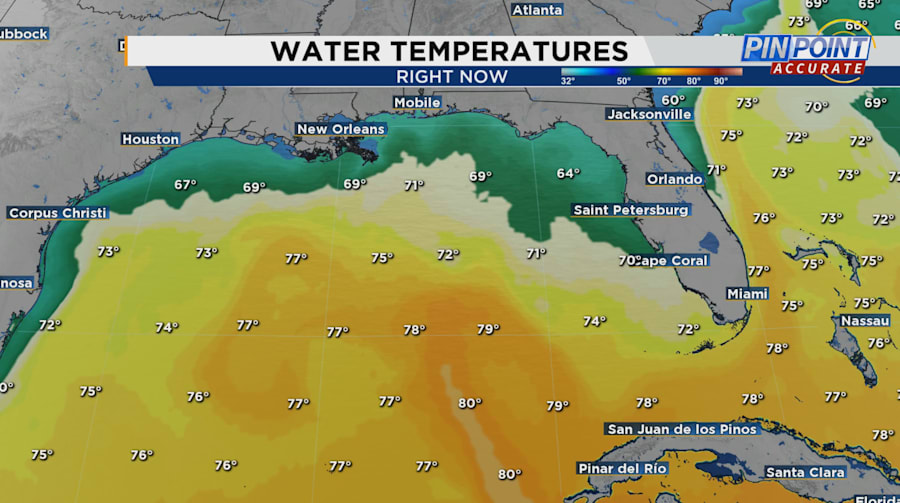
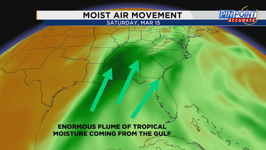
We’re also currently witnessing lots of warming occurring in the equatorial Pacific and to our immediate west in the western Gulf waters. All this accumulated warmth adds to the unstable nature of the atmosphere, and also helps produce even MORE water vapor than traditionally expected.
The heat produced by the water temperatures helps create additional lift and wind in the atmosphere. On a local scale, we will feel it in way of a greater chance for rain week by week. At the large scale, features like the subtropical jet change the path storm systems take, which also produce greater or lesser severe storms for us Central Floridians.

Couple that with a few major frontal systems coming across the northern United States and you have the perfect combination for severe weather.
Finally, there are two other long-range whispers of bad weather on the horizon for the final days of March and then into the first week of April.
As we close out this morning, I want to add an ENORMOUS DISCLAIMER — looking this far out in time comes with risks. What we’re utilizing here together is a technique called “pattern recognition,” which is a tried and true method. We’re not simply looking at computer models showing fancy or flashy colors over our area.
If the big-picture weather pattern makes sense — jet stream coming in from up north, warm air and moisture being transported across the area, and a solid gradient in temperature differences working northwest to southeast — you can easily make a case for potent weather coming your way.
I do anticipate changes! But regardless, after the events of Monday morning, I think it’s best to keep us all ahead of the storm and on top of our weather situational awareness as much as possible.

More Stories Like This In Our Email Newsletter


