

ORLANDO, Fla. – The Easter weekend has arrived, and a number of festivities are already underway in Central Florida.
Mother Nature is fully cooperating as well, giving us plenty of sunshine, a nice breeze, and mostly clear skies. A stark contrast to the repetitive severe weather weekends we seemed to face constantly through the end of March and early April.

However, with weather it’s always a give and take. A dome of high pressure has settled in over the Sunshine State – and it doesn’t look to be going anywhere – at least for the foreseeable future.
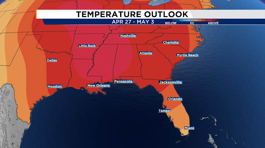
Temperatures are going to continue to balloon upwards, reaching the 90s for your week ahead.
Computer models seemed focused on bringing rain chances back for all of us by about 23-24 April.
But because of this stubborn ridge of high pressure acting as a speedbump for the atmosphere, the moisture isn’t quite going to make its way into our neighborhood just yet.
The new date we’re pinpointing for a resurrection of our afternoon sea breeze has been bumped to the last few days of the month.
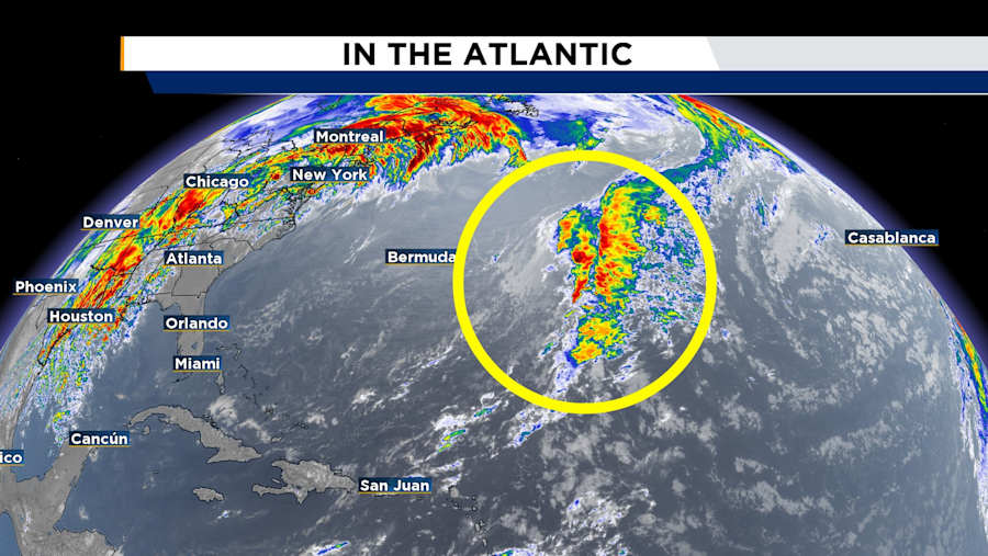
As we start the countdown to May 1, there’s some subtropical moisture out in the Atlantic that may finally move in to Florida and produce showers and occasional storms.
But this is still a ways out. Today is April 19, and our earliest shot for a noticeable chance for rain appears to be April 28 if not the 29th.
A lot hinges on our Bermuda-Azores high pressure to our east across the Atlantic, and an interesting wave of leftover frontal energy that will get dragged westward as a result of the winds flowing around the high pressure.
For now, I hope you take full advantage of this incredible pool, water park, beach, barbecue, fishing, you name it kind of weather! Get out and about if you haven’t already.


